Genoa Cristoforo Colombo Airport (GOA)
Driving Directions / Travel by Car
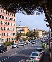
(Genoa, Italy)
Genoa Cristoforo Colombo Airport (GOA) is directly connected to Italy's motorway system via the A10 / E25 (Autostrada dei Fiori) and passengers arriving at the airport can quickly access central Genoa, Piedmont, Lombardy and the Alps.
The city of Genoa is 6 km / 4 miles from the airport, which is signposted locally as the 'Aeroporto Cristoforo Colombo Genova'.
Also near to Genoa Airport, the A12 / E80 (Autostrada Azzurra) lies to the north and intersects the A7 / E80 to the west, which heads towards the airport. Close to Cristoforo Colombo Airport, Borzoli, Cantalupo and Madonna del Gazzo are all situated to the north.
Directions to Genoa Cristoforo Colombo Airport (GOA) from the north:
- Take the A7 south and then the A10 west
- Exit south on a heading for Cornigliano Ligure and Genoa Airport
Directions to Genoa Cristoforo Colombo Airport (GOA) from the east:
- Head west from central Genoa on Strada Aldo Moro
- The SS1 (Strada Aldo Moro) north-west is the most direct route from here, or alternatively you take the A7, A10 and the airport exit
Directions to Genoa Cristoforo Colombo Airport (GOA) from the west:
- Take the A10 east towards Genoa
- Exit south on a heading for Cornigliano Ligure and Genoa Airport and follow the signs
Italy's city roads are notoriously congested during the day and particularly during the morning and early evening. If you are travelling to Cristoforo Colombo Airport from Genoa during these times of the day, allow yourself plenty of time.
Genoa Cristoforo Colombo Airport (GOA): Virtual Google Maps
